Amazing news!
The already vital Google Maps converts to public transport!!
If until today you needed to connect to the local public transport website in order to plan an itinerary in Italian cities (in Rome atac. roma.it) now for all the main Italian cities (Rome, Milan , Turin , Bologna, Firenze and so on) Google Maps is offering this free service!
you can check the following link to verify if the system covers your city:
http://maps.google.it/intl/it/landing/transit/
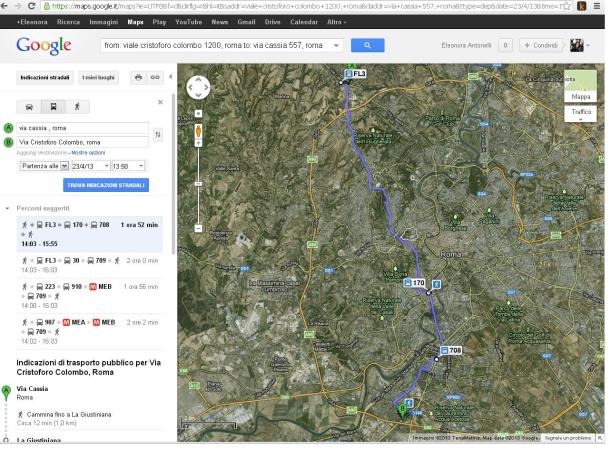
then all you need to do is inserting the starting and final addresses and clicking the bus icon 

 in order to have all the public transport options for your itinerary!
All the possible public tranport means are considered: regional trains, underground(MEA and MEB), tram and buses ![]()
The service works also for itineraries between the city and the near towns (I tried Rome to Tivoli)!
I tested various itineraries inside Rome, and the service is perfect: I mean Google service, obviously, since Rome public transport has big space for improvements : also Google Maps confirms, in order to cross the city of Rome from North to South (for example between Via Cassia to Eur) with any available option with any available means (trains , Underground/buses) you will need at least 2 hours (you’d better grab a book before leaving) !
Enjoy your plan and your travel (and your reading too) i!

